
Return Data Settings
You can return additional data with each address you retrieve from our service. This includes geocodes (such as latitude and longitude), as well as other data like administrative boundaries or building details.
To choose which data is returned, go to Settings → Return Data on your chosen integration and select the data you need. Any data you select will be included in the data object of each address returned.
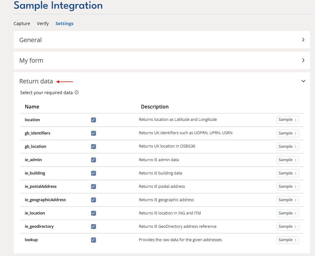
The tables below describes each data type available, along with a sample of the object it returns.
Location
Returns location data such as Latitude and Longitude.
Field Info | Description |
|---|---|
longitude | Longitude of matched address |
latitude | Latitude of matched address |
crs | Coordinate reference system |
accuracy | Returns the accuracy of the matched address. |
gb_identifiers
Returns identifiers for the UK such as UDPRN, UPRN, USRN.
Field Info | Description |
|---|---|
uprn | Unique Property Reference Number |
udprn | Unique Delivery Point Reference Number |
umrrn | Unique Multiple Residence Reference Number |
usrn | Unique Street Reference Number |
gb_location
Returns UK location data such as easting and northing.
Field Info | Description |
|---|---|
easting | Easting coordinates of matched address |
northing | Northing coordinates of matched address |
crs | Coordinate reference system |
ie_admin
Returns IE admin data.
Field Info | Description |
|---|---|
smallAreaId_2022 | Small Area ID - 2022 data |
smallAreaId_2017 | Small Area ID - 2017 data |
smallAreaId_2015 | Small Area ID - 2015 data |
laId_2022 | Local Authority ID - 2022 data |
laId_2017 | Local Authority ID - 2017 data |
laId_2015 | Local Authority ID - 2015 data |
leaId_2019 | Local Electoral Area ID - 2019 data |
leaId_2018 | Local Electoral Area ID - 2018 data |
dedId_2022 | Electoral District - 2022 data |
dedId_2017 | Electoral District - 2017 data |
dedId_2015 | Electoral District - 2015 data |
countyId | County ID |
gaeltacht | A true/false field, that highlights if the ecadId supplied is in a Gaeltacht area. |
ie_building
Returns IE building data.
Field Info | Description |
|---|---|
ecadId | Unique 10 digit identification number |
buildingTypeId | Type of Building |
underConstruction | A true/false field, indicating whether or not the building is under construction |
buildingUse | Possible options: |
vacant | A true/false field, indicating whether or not the building is under construction |
ie_postalAddress
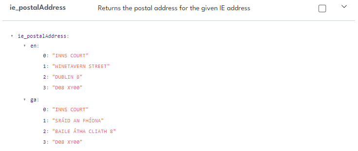
Returns the postal address for the given IE address - this is returned in English and Irish.
ie_geographicAddress
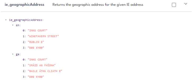
Returns the geographic address for the given IE address - this is returned in English and Irish.
ie_location
Returns IE location data for given address.
Field Info | Description |
|---|---|
ing | Irish national grid information, including easting, northing and may include a bounding box |
itm | Irish transverse mercator, including easting, northing and may include a bounding box |
accuracy | The accuracy level of the geo-coordinate provided. |
ie_geodirectory
Returns IE GeoDirectory address reference.
Field Info | Description |
|---|---|
ie_geodirectory | GeoDirectory identifiers for an Irish address. |
addressReference | The unique GeoDirectory Address Reference for the address. Use it to match the address against other GeoDirectory datasets or systems that use the same reference. |
lookup
Provides the raw data for the given addresses.